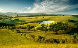
Fast Water Of The Kamchia River. The Golyama Kamchiya River Originates From Lisa Mountain, 760 M Above Sea Level, About 7 Km West Of Bratan Village, Kotel Municipality. Near The Village Of Ticha, It Flows In An Easterly Direction In A Narrow And Deep Valley Overgrown With Deciduous Forests. Then It Turns To The Northeast, Its Valley Widens And Flows Through The Historical-Geographical Region Of Gerlovo. Near The Village Of Golyamo Tsarkvishte, Omurtag Municipality, It Turns East Again, Enters The Shumen Region And Its Waters Flow Into The Large `Ticha` Dam. After Its Outflow From The Dam Wall, Its Direction Again Becomes Northeast And Forms A Picturesque Gorge Between The Preslavska Planina In The Northwest And The Dragoevska Planina In The Southeast.
ID 265788911 © Flygallery | Megapixl.com
Your image is downloading.
Sharing is not just caring, it's also about giving credit - add this image to your page and give credit to the talented photographer who captured it.:


