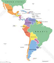
Latin America Countries Political Map With National Borders. Countries From The Northern Border Of Mexico To The Southern Tip Of South America, Including The Caribbean. English Labeling. Illustration.
ID 864453173715 © Peterhermesfurian | Megapixl.com
CATEGORIES
Your image is downloading.
Sharing is not just caring, it's also about giving credit - add this image to your page and give credit to the talented photographer who captured it.:


