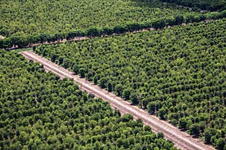
Ord River, Kununurra, Western Australia. The Ord River Is A 320-Kilometre 200 Mi Long River In The Kimberley Region Of Western Australia. The River`s Catchment Covers 46,100 Square Kilometres 17,799 Sq Mi. The Lower Ord River And The Conjunction With Cambridge Gulf Create The Most Northern Estuarine Environment In Western Australia. The Ord River Irrigation Scheme Was Built In Stages During The 20Th Century. The Lower Reaches Of The River Support An Important Wetland Area Known As The Ord River Floodplain, A Protected Area Which Contains Numerous Mangrove Forests, Lagoons, Creeks, Flats And Extensive Floodplains. The Traditional Owners Are The Miriwoong Gajerrong Peoples Who Have Inhabited The Area For Thousands Of Years And Knew The Ord River As Goonoonoorrang
ID 165258827745 © Mauriehill | Megapixl.com
Your image is downloading.
Sharing is not just caring, it's also about giving credit - add this image to your page and give credit to the talented photographer who captured it.:


