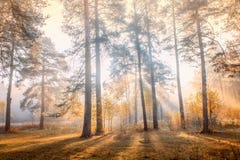
Pine Trees On The Shore Of Baikal Lake. Hot Weather And Bright Sunny Day. Olkhon Island, Russia. Olkhon Is The Third-Largest Lake Island In The World. It Is By Far The Largest Island In Lake Baikal In Eastern Siberia, With An Area Of 730 Sq Km. Structurally, It Constitutes The Southwestern Margin Of The Academician Ridge. The Island Measures 71.5 Km In Length And 20.8 Km In Width. Most Residents Are Fishermen, Farmers, Or Cattle-Ranchers. Olkhon Has A Dramatic Combination Of Terrain And Is Rich In Archaeological Landmarks. Steep Mountains Line Its Eastern Shore, And At 1,276 M Above Sea Level, Mount Zhima Is The Highest Point On The Island, Peaking At 818 M Above The Water Level Of Lake Baikal. The Island Is Large Enough To Have Its Own Lakes, And Features A Combination Of Taiga, Steppe And Even A Small Desert. A Deep Strait Separates The Island From The Land. The Island`s Appearance Is A Result Of Millions Of Years Of Tectonic Movement Resulting In The Hollowing Of The Channel Between The Land - Maloe More Sound And Olkhon Gate Strait - And The Block Of Stone Forming The Island. The Steep Slopes Of The Mountains Show The Vertical Heave Of The Earth. Due To An Increasing Number Of Tourists From All Over The World, Many Residents Work In This Sector As Well, And Tourism Has Become An Important Part Of The Economy In Olkhon. Baikal Lake, Russia
ID 182569050 © Rechitansorin | Megapixl.com
CATEGORIES
Sharing is not just caring, it's also about giving credit - add this image to your page and give credit to the talented photographer who captured it.:
KEYWORDS
asia baikal boat cold communications cottage countryside cow environment exterior fence hill house island izba journey khuzhir khuzir lake landmark landscape natural nature nobody old olhon olkhon outdoor place russia russian scenery scenic settlement ship shore siberia siberian sights site sky snow style tour tourism tower traditional transmission view village winter wooden yellow


